A tropical storm As of Tuesday, Erin remained a weak storm, but analysts anticipate that this may alter over the coming few days.
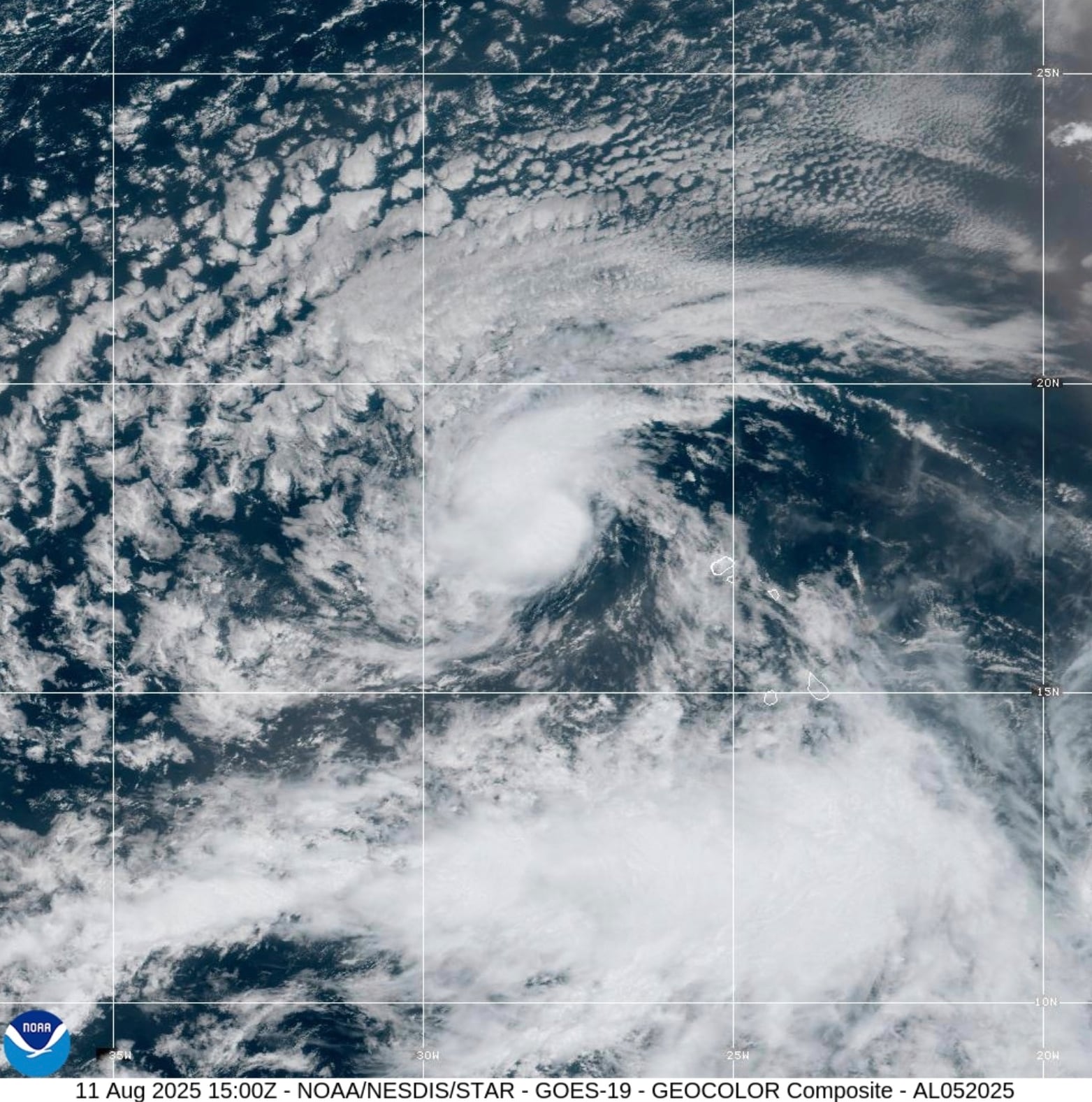
The National Hurricane Center reports that Erin, the fifth named storm of 2025 in the Atlantic, was located far out in the eastern Atlantic on Tuesday and had winds of 45 mph.
Since it was too soon to rule out threats to the United States, there was still a lot of conjecture surrounding Erin’s long-range course.
The storm, which may reach a Category 3 hurricane by the end of this week, is predicted by numerous forecast models to move westward before turning north and then northeast to avoid the U.S. East Coast.
Forecasters warn, however, that it is much too soon to make that determination.
On Tuesday, the National Hurricane Center released the following statement regarding Erin:
What effects Erin might have on Bermuda, the east coast of the United States, or the northern Leeward Islands is currently too early to tell. This is a good time to make sure your preparations are in place as the hurricane season’s climatological peak draws near.
Tropical Storm Erin was roughly 1,890 miles east of the Leeward Islands at 4 a.m. CDT on Tuesday, and it was traveling westward at a speed of 22 mph.
Erin was a weak tropical storm with sustained winds of 45 mph.
Erin is expected to intensify into a hurricane on Wednesday or Thursday, with winds of 74 mph and more, according to the hurricane center.
By early Sunday, it might be a Category 3 hurricane with maximum sustained winds of 115 mph. The storm can then be north or close to the Leeward Islands.
Erin and a powerful area of high pressure located to the storm’s north will be monitored by the hurricane center.
Although forecasts believe a weakness could form in the area of high pressure, allowing the tropical storm to move more to the north, that area of high pressure should keep Erin moving westward.
Erin’s route has been moved slightly to the south from earlier predictions according to the hurricane center’s most recent official forecast track.
ELSEWHERE IN THE ATLANTIC
The Gulf was one of two other areas of disturbed weather being monitored by the storm center.
Although it was not anticipated that the system would turn into a tropical storm, Alabama and other Gulf Coast states would see rainy spells during the course of the following day.
Areas along Alabama’s coast could receive 2 to 4 inches of rain in a short period of time if some of the heavier showers pass over the region, according to the National Weather Service in Mobile.
As the disturbance moves inland to the west of Alabama, more normal rain chances are predicted to return to the state beginning Wednesday.
Off the coast of Nova Scotia, the hurricane center was also keeping an eye on a non-tropical region of low pressure that was predicted to pass over colder waters in a day or two and not develop into a tropical system.
June 1 marks the start of the Atlantic hurricane season, which finishes on November 30.
This season, there have been five named storms but no hurricanes.
Before the season ends, NOAA predicts 13–18 named storms.