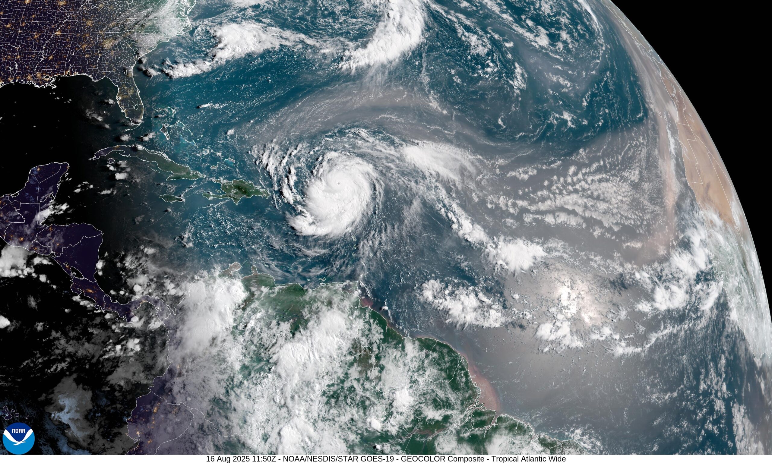
Hurricane Erin intensified on Saturday, reaching 155 mph and almost reaching Category 5 status.
More intensification is anticipated today, according to the National Hurricane Center.
Could Erin develop into the strongest hurricane on the Saffir-Simpson Scale, a Category 5? According to the hurricane center, it is possible. At 157 mph, category 5 winds start.
As of Saturday AM, the hurricane center said that Erin was moving north of the Leeward Islands and that some of the islands were starting to feel the effects of the storm’s outer rain bands.
Over the weekend, the hurricane was predicted to remain north of Puerto Rico and the islands.
There is also excellent news for the United States based on the long-range course from the storm center. The storm stays far from the East Coast on the official route.
Beginning this weekend, the anticipated track shifts Erin farther to the north before recurving the storm to the northeast and away from the United States.
But Bermuda will need to keep a tight eye on Erin. The island is hardly in the so-called cone of uncertainty, which shows the potential location of the core.
Although the northern Leeward Islands were under tropical storm watches, the worst of the storm was predicted to remain well north of the islands, Puerto Rico, and the Virgin Islands.
Category 4 Hurricane Erin was roughly 235 miles east-northeast of San Juan, Puerto Rico, and was moving westward at 17 mph as of 10 a.m. CDT on Saturday.
Sint Maarten and the islands of St. Martin and St. Barthelemy were still under a tropical storm watch.
Over the weekend, the center of Erin is predicted to pass slightly north of Puerto Rico, the Virgin Islands, and the northern Leeward Islands, according to the hurricane center’s forecast track.
Through Sunday, Erin is expected to produce 2 to 4 inches of rain to the Virgin Islands, Puerto Rico, and the northern Leeward Islands, with some regions potentially receiving up to 6 inches.
Early next week, the storm center also issued warnings about the danger of lethal rip currents around the U.S. East Coast, Bermuda, and the Bahamas.