As Hurricane Erin started its closest approach to the United States on Wednesday, it appeared to be a powerful storm while being weaker.
Erin will cruise between the East Coast and Bermuda during the next few days before bending out to sea, while it is not anticipated to make landfall in the United States.
However, as rain bands from the storm reach North Carolina, where a tropical storm warning is still in effect, the U.S. will feel Erin’s influence, particularly starting today.
By this evening, the outer bands of Erin are expected to deliver severe weather to the coast of North Carolina, according to the National Hurricane Center.
Beachgoers are advised not to swim at the majority of U.S. East Coast beaches because of the potentially fatal surf and rip currents, according to forecasters.
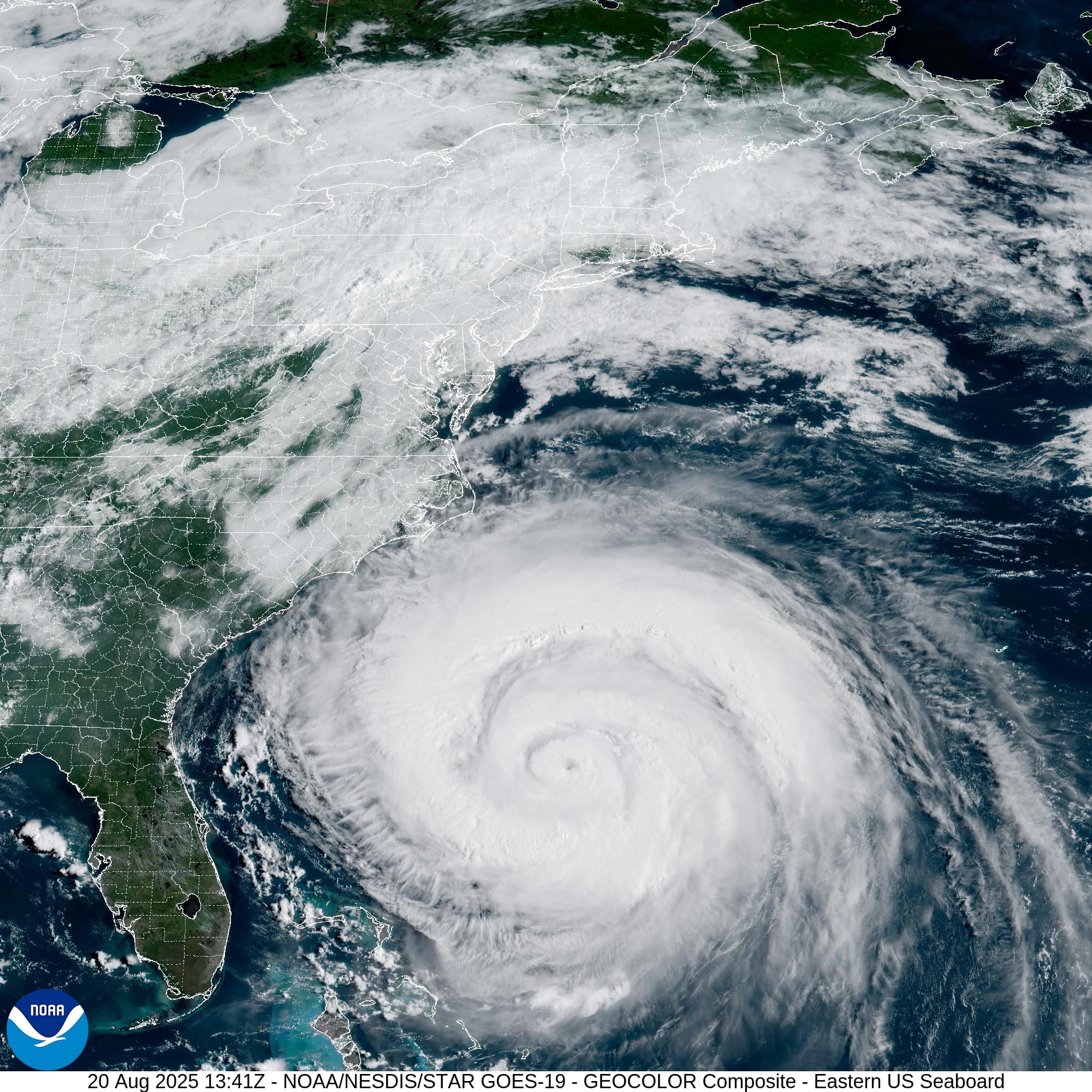
At 7 a.m. CDT on Wednesday, Category 2 Hurricane Erin was traveling to the north-northwest at 13 mph, with its core roughly 400 miles south-southeast of Cape Hatteras, N.C., or 560 miles west-southwest of Bermuda.
With sustained winds of 100 mph, Erin was classified as a Category 2 storm.
Erin may strengthen today, according to the hurricane center, but it should start to weaken by Friday.
The core of Erin will move between the U.S. East Coast and Bermuda through early Friday, before moving south of Atlantic Canada on Friday and Saturday, according to the hurricane center’s official predicted path.
From Cape Lookout to Duck, the North Carolina coast is still under a storm surge warning. According to the storm center, surges of two to four feet might occur in certain places.
From Beaufort Inlet, North Carolina, to the boundary between North Carolina and Virginia, which includes the Pamlico and Albemarle sounds, a tropical storm warning is in effect.
From north of the North Carolina/Virginia line to Chincoteague, Virginia, and Bermuda, a tropical storm watch is in force.
Tropical storm conditions are predicted for the Outer Banks of North Carolina starting late today or tonight, according to the hurricane center.
On Thursday and Friday, Bermuda and Virginia’s Atlantic coast may see tropical storm characteristics.
Deadly rip currents will remain a major issue along the U.S. East Coast. Over the following few days, waves from Erin will impact the East Coast, the Bahamas, Bermuda, and Atlantic Canada, according to the hurricane center.
Today, there will be a significant chance of rip currents from Florida to New York along the East Coast:
According to the hurricane center, Erin may also deliver 1-2 inches of rain to some areas of North Carolina.