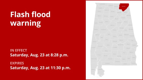
At 8:28 p.m. on Saturday, the National Weather Service issued a flash flood warning for Jackson County, which was in force until 11:30 p.m.
“Doppler radar showed thunderstorms causing heavy rain in the notified area at 8:28 p.m. There has been one to three inches of rain. The cautioned area may see an additional 1 to 2 inches of rainfall. Flash flooding is continuing or likely to commence shortly,” states the weather agency. “Flash flooding of small creeks and streams, urban areas, highways, streets and underpasses as well as other poor drainage and low-lying areas.”
Bridgeport, Stevenson, Hollywood, Skyline, Pleasant Groves, Fackler, Martintown, Bass, Fabius, and Hollytree are among the places affected by the warning.
“Turn around, don’t drown when encountering flooded roads,” the weather agency adds. Vehicles are the primary cause of flood fatalities. At night, when it is more difficult to identify the risks of flooding, use extra caution.
Breaking down weather alerts: advisories, watches, and warnings
-
Flash flood warning: Take action!
When a flash flood is approaching or already happening, a warning is sent. Get to high ground right away if you’re in a flood-prone location. A flash flood is a quick, intense flood that can form in a matter of minutes to hours. Even in places that don’t get rain right away, flash floods can happen.
-
Flood warning: Take action!
When flooding is about to occur or has already started, a flood warning is issued.
-
Flood advisory: Be aware:
When flooding is not predicted to be severe enough to warrant a warning, a flood advisory is issued. But if care is not taken, it could result in circumstances that endanger life and/or property and cause a great deal of discomfort.
-
Flood watch: Be prepared:
When the weather is conducive to flooding, a flood watch is issued. Although it doesn’t ensure flooding will happen, it does indicate that it is a potential.
When floods strike: Guidelines from the weather service for your protection
Knowing and adhering to the weather service’s flood safety recommendations can be extremely helpful when camping in low-lying areas or in locations that are prone to flooding:
Look for higher ground.
Moving to higher ground is the first line of defense if you live in an area that floods easily or are camping in a low-lying area.
Respect evacuation directives:
Immediately comply with any evacuation orders issued by local authorities. Make sure your house is locked before you leave.
Cut off appliances and utilities:
If time allowed, disconnect your utilities and appliances. This precaution decreases electrical threats during flooding.
Avoid drowned places and flooding basements:
Avoid basements or rooms with electrical outlets or cords submerged in water. This lessens the chance of electrical mishaps.
Quickly leave for your safety:
Evacuate right away if you see sparks or hear popping, crackling, snapping, or buzzing noises. Avoid going into water that might be electrically charged.
Avoid going on foot in floodwaters:
Even if floodwaters seem shallow, you should never try to go over them. You can be swept off your feet with power by just 6 inches of swift-moving water.
If you’re stuck, look for high ground:
If you find yourself caught by flowing water, move to the highest spot you can and dial 911 to reach rescue personnel.
Flooding is a possibility when there is a lot of rain, especially in low-lying or flood-prone locations. Even though it can seem shallow, it is imperative that you never drive through water on the road. The weather service claims that most cars can be washed away by as little as 12 inches of swift-moving water. Put your safety first by being aware and ready.
Driving through downpours: Safety guidelines for wet roads
There is a greater chance of floods and dangerous roadways when it rains a lot. The weather service has provided the following advice to help you keep safe during downpours:
Watch out for swift water flow:
Avoid parking or strolling close to culverts or drainage ditches during periods of intense precipitation, as the swift-moving water can be quite dangerous.
Keep your distances from other vehicles safe:
In heavy rain, the two-second rule of following distance is your friend. To guarantee safe spacing under unfavorable circumstances, increase it to four seconds.
Slow down and drive carefully:
It’s crucial to slow down on wet roads. To avoid sliding, reduce the accelerator gradually and don’t brake suddenly.
Pick your lane carefully:
On multilane highways, stay in the middle lanes to reduce the chance of hydroplaning because water tends to pool in the outer lanes.
Put visibility first:
As rain-spattered windows make it more difficult to see other vehicles, turn on your headlights and pay attention to those in blind spots and behind you.
Be cautious on slick roads:
During the first half hour after the rain starts, exercise additional caution. The road becomes slick when water combines with dirt and oil on the surface.
Stay a safe distance away from big cars:
Avoid following buses or big vehicles too closely. Their big tires produce a mist that blurs your eyesight. Additionally, if you have to pass them, proceed with caution.
Be mindful of your wipers:
-
Heavy rain can overload the wiper blades. When visibility is so limited that the edges of the road or other vehicles cannot be seen at a safe distance, it is time to pull over and wait for the rain to ease up. It is best to stop at rest areas or other protected areas.
-
When stopping by the roadside is your only option, position your vehicle as far off the road as possible, ideally beyond guardrails. Keep your headlights on and activate emergency flashers to alert other drivers of your position.
Taking these safety measures will significantly improve your road safety while it’s raining a lot. For a safe trip, keep yourself updated on weather conditions and follow local authorities’ instructions.
United Robots offers a service called Advance Local Weather Alerts that gathers the most recent information from the National Weather Service using machine learning.