The southern part of Alabama may get a few strong thunderstorms on Saturday.
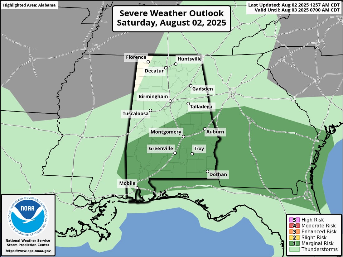
As seen in the graphic at the top of this piece, NOAA’s Storm Prediction Center has extended a Level 1 out of 5 (marginal) risk for severe weather for Saturday to cover the southern portion of central Alabama and the majority of south Alabama, with the exception of the coast.
A Level 1 risk indicates the possibility of isolated severe storms. The strongest of those, according to the SPC, may bring frequent lightning, heavy rain, and destructive wind gusts that might down trees and power lines.
The National Weather Service says Saturday might see rain and storms all day long, but this afternoon and tonight are when storms are most likely to occur.
As of Saturday morning, there are no heat advisories in force for any area of Alabama, which is a nice change, and the anticipated rain will help control the temperatures.
Today’s highs will be in the lower 90s in south Alabama and the lower 80s in northeast Alabama.
The high temperature prediction for today is as follows:
According to weather service estimates, Sunday is still projected to be at least one degree cooler, with highs in the 80s predicted for a large portion of the state.
In fact, some fortunate locations in northeast Alabama might experience daytime temperatures in the 70s.
The outlook for Sunday is as follows:
The weather service says there will be no organized severe weather on Sunday, but the likelihood of rain is still high for much of Alabama.
The likelihood of rain through 7 p.m. on Sunday is as follows: